|
|
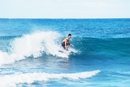
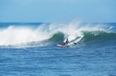
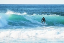
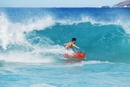
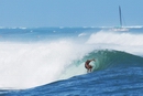
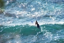
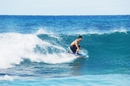
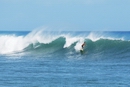
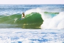
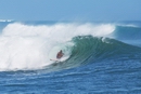
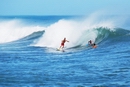
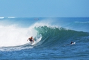
| Lanai Magazine - Surfing, Lanai, Hawaii |
| Lanai, Hawaii |
|
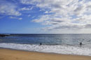
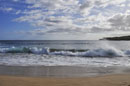
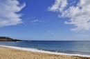
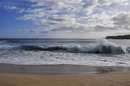
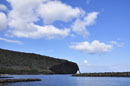
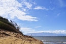
Hulopo'e Beach |
 |
|
Take Highway 440 south from Lanai City approximately 13 miles. Follow the signs to the Hulopo'e Beach Park. Protected bay located in the Hulopo'o-Manele Marine Life Conservation Area. White sand beach. Has restroom facilities,showers, phone, picnic tables, grills, grass and shaded areas. No lifeguard. |
| Lanai, Hawaii |
|
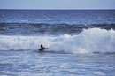
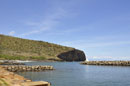
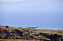
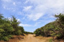
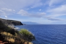
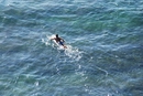
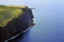
Kaunolu Bay |
 |
|
Take Highway 440 west out of Lanai City toward Kaumalapau Harbor. Go past the airport turnoff and take the next left Kaupili Road, an unmarked dirt road. Travel approximately 2.5 miles to a yellow standpipe on the right. Turn right on this rocky road which descends downhill about 3 miles to Kaunolu Village. The intrepretive hike is on the right, well marked above the bay. Frequent high surf. No facilities. |
 |
| Lanai, Hawaii |
|
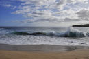
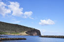
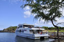
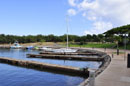
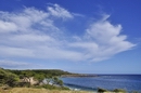
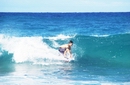
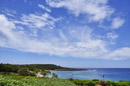
Manele Bay |
 |
|
Take Highway 440 south from Lanai City. Turn left at the end of the highway onto New Manele Road. The harbor is located at the end of this road. Approximate drive time from town is 25 minutes.
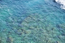
Manele Bay has Lanai's only public harbor. It’s where you arrive when you take the ferry from Maui to Lanai. Manele Bay is a marine preserve, established to protect and preserve the area’s marine resources and geological features. There is only a small white sand beach at the east end of the bay. Good for snorkeling and diving. Shade, picnic facilities, pavilion, and grills are available above the harbor area. |
|
| Lanai, Hawaii |
|
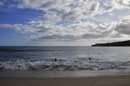
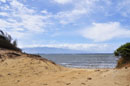
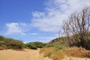
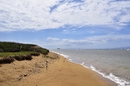
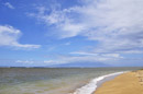
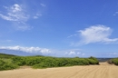
Lopa Beach |
 |
|
Take Highway 430 north out of Lanai City to the end, take branching off the Keomuku Road.
It is a long white sand beach. It begins on the south side of Kikoa Point and ends past an old fishpond, which is the most outstanding feature on this beach. The fishpond is also called Loko Lopa and has been designated as a bird sanctuary. Swimming possible when the waters are calm. Good fishing. No facilities and no lifeguards here.
|
|
| Lanai, Hawaii |
|
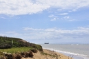
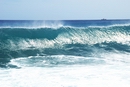
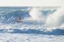
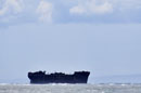
Shipwreck Beach |
|
|
From Lanai City, take Highway 44 northeast to the end of the road (approximately 7 miles). Turn left on the dirt road and continue for 1.6 miles to the parking area near the lighthouse ruins. Shipwreck Beach lies in front of the ruins and stretches for several miles to the north and east. Accessible only by 4-wheel drive vehicle. Be sure to check on road conditions before starting out.
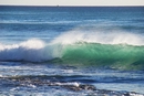
The beach stretches over miles of northeast coast of Lanai fronting the Kalohi Channel that separates Lanai from Molokai. This channel is known for its strong currents and numerous reefs. Many a ship has run aground along this channel - thus the name, Shipwreck Beach. The World War II Liberty Ship whose hulk clings to reef close to shore. The beach is a series of sand, lava rock, and boulders. It is a great place for beach combing, swimming in this area is extremely unsafe. Great hiking. Good shore fishing. No lifeguards. No facilities anywhere nearby. Large shipwreck located approximately one mile down the beach to the left of the lighthouse ruins. Petroglyphs located near the lighthouse ruins. A entire fishing village, Federation Camp, was built from the debris washed ashore here. Kaiolohia-Kahue Trail starts from the beach. |
|
|
|